Finally, the Sierra! I cannot think of a more appropriate reward for enduring the desert's heat and water shortages. Water flows all around, there's actual grass, and it's cool! The transition from desert to glorious mountains was quick. A cicada cacophony greeted us too.
 |
| My lunch spot |
 |
| Great root systems |


 |
| The climb out of the desert |

 |
| Crabtree Meadows |
 |
| Almost near the top of Mt. Whitney around 5AM - the morning light illuminated the valley |
 |
| More Whitney Climb |
 |
| Highest point in the continental US! |
 |
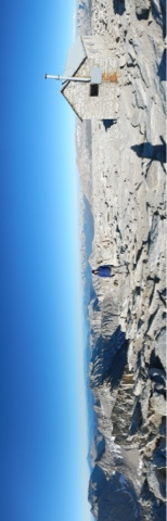
| Shelter on top of Whitney |

 |
| Some years the hikers would have to go through snow the whole way |
 |
| Guitar Lake on the right |


 |
| The climb towards Forester Pass, the highest point on the PCT |


 |
| Highest point on the PCT and the line between Kings Canyon and Sequoia National Park |


 |
| The climb over Kearsarge Pass into Independence |

Wow. The next-to-last photo is especially stunning. Looks like it was worth the walk.
ReplyDelete